
1. What does the road leave behind?
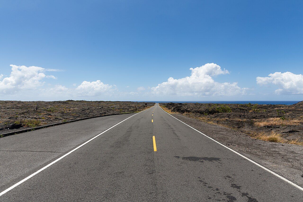
What does a road down a volcano show that the summit can’t? Chain of Craters Road begins among cloud-damp trees on Kīlauea’s rim, then descends toward the ocean over dark volcanic ground.
It falls about 3,700 feet over roughly 19 miles, passing through a striking range of volcanic ground. This is a dead-end road, so the drive down and the return up share the same pavement, though the changing landscape makes them feel like separate journeys. I like that the return isn’t simply a replay; the forest comes back slowly, and the coast begins to feel far away.
There’s no fuel, food or drinking water along the road, and mobile signal is patchy. A drive with several walks becomes most of a day, rather than a quick look at the ocean, so the contents of the car matter as much as the route.
2. What lies under the upper forest?
The first stretch follows pit craters along Kīlauea’s upper east rift zone. They aren’t cones built up by eruptions, but collapse pits: the ground sank into spaces left behind as magma moved underground. Their edges appear one after another beside the road, each with a pullout and sign.
Lua Manu, Puhimau, Koʻokoʻolau, Hiʻiaka and Pauahi are among the named craters. Vegetation softens some rims; elsewhere the sides drop away, bare and steep. Puhimau has a particular quiet depth, while Pauahi shows fresher lava on its floor. I’d choose a couple to linger over instead of turning every pullout into a checklist.
The damp ʻōhiʻa woodland around them is familiar from near the summit, but the views open onto the pits. Mist slips across the far walls, making them appear and disappear; birds call overhead, and wet earth and ferns scent the air. The rims are loose and undercut, so the view belongs from behind the railings.
3. When does the forest give way?
Farther down, the canopy thins and the road crosses open lava. Much of this ground came from Mauna Ulu, a vent that erupted for several years from 1969 and buried long sections of the original road. The present road cuts through the flows, while older forest survives on higher islands of ground.
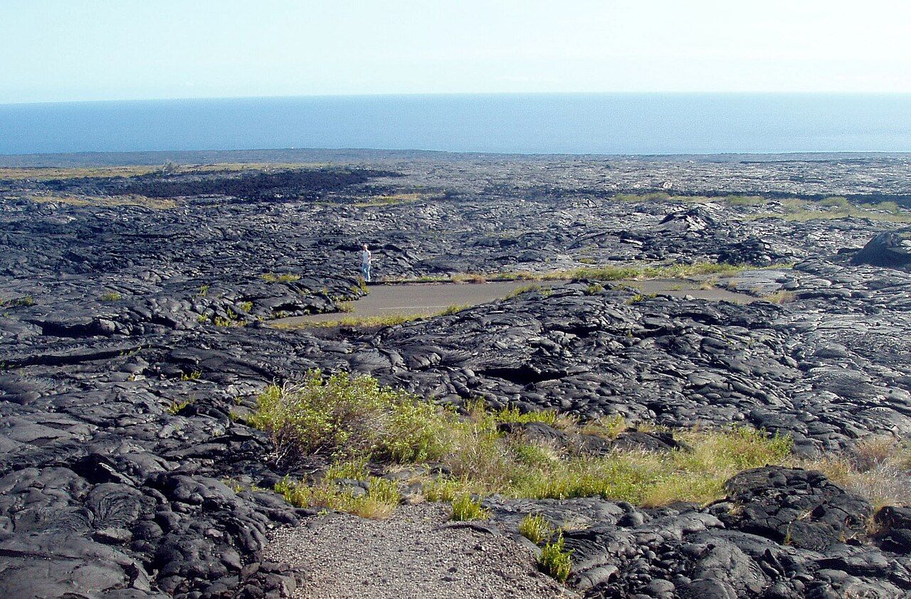

The lava has two very different surfaces here. Pāhoehoe, smooth and rope-like, sits beside ʻaʻā, a rough jumble of clinkery rock; both Hawaiian words have become part of geology around the world. From a pullout, the contrast is easy to read: one surface looks folded, the other broken and sharp. Looking closely is enough; the rock stays where it lies.
Lava rock belongs where it lies, and removing it from the park is both illegal and deeply disrespectful in Hawaiian tradition.
Lava rock belongs where it lies, and removing it from the park is both illegal and deeply disrespectful in Hawaiian tradition.
The road’s black flows are part of a much longer story, and the eruptions of Kīlauea gives Mauna Ulu and the long eruption that followed it a wider frame.
4. How does the road cross the pali?
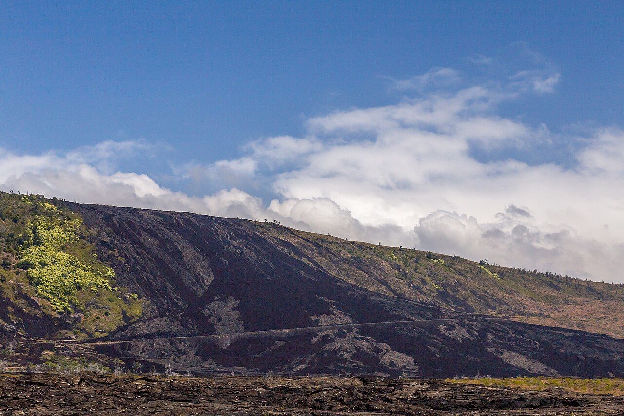
Halfway down, the road reaches steep cliffs called pali, formed as the volcano’s flank slumps toward the sea. From Kealakomo overlook, the coastline opens below; beyond it, Hōlei Pali’s switchbacks cross dark flows that spilled over the cliff in long tongues.

Read next: A walk from forest to lava lake
This is the part where the road itself asks for attention. The bends are sharp, the shoulders narrow, and drivers sometimes pull out suddenly to stop for photographs. Marked pullouts make more sense than an improvised stop, and faster traffic can pass there too.
5. What is carved into Puʻu Loa?
Near the bottom of the pali, a short trail crosses old pāhoehoe to Puʻu Loa, one of Hawaiʻi’s largest petroglyph fields. Many thousands of images are carved into the rock: human figures, circles, dots and lines. A great many are small, cup-shaped holes.
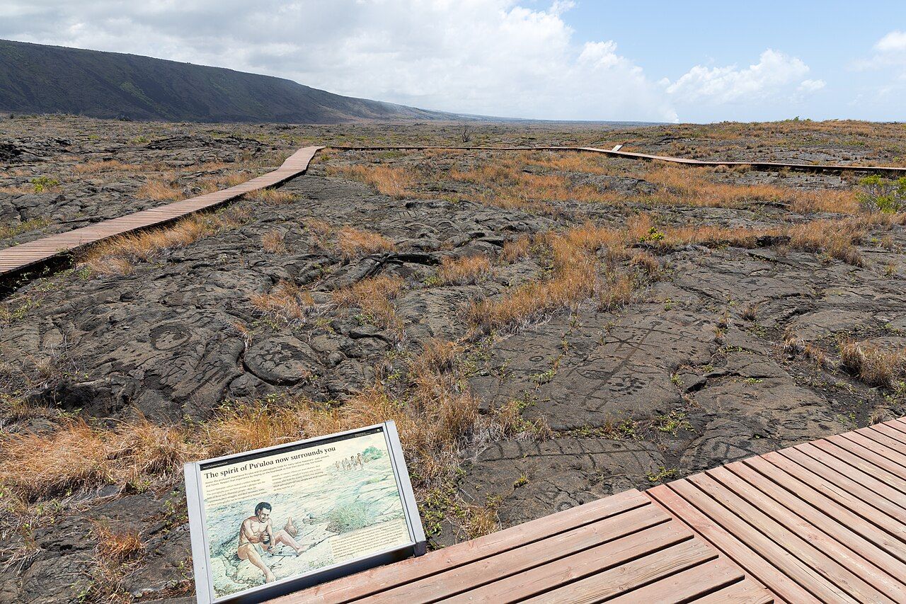

Hawaiian families are said to have placed a newborn’s piko, or umbilical cord, in one of these holes as a wish for a long life. That history changes the feeling of the place; these carvings aren’t scenery arranged for a passing look, but a site with family meaning.
The trail is brief and nearly flat, though it crosses exposed lava without shade. A boardwalk circles the main area, and staying on it keeps feet off the carvings. Don’t step on, rub or make rubbings of them; even light pressure wears the rock away. I prefer the quiet, attentive pace this place calls for.
6. Where does the pavement stop?
At the bottom, the road levels out along the coast and runs to a barrier, where lava from the long Puʻu ʻŌʻō eruption covered the pavement. Old flows continue toward the horizon beyond it, and the road disappears beneath them. Facilities at the end are basic at best, with no drinking water.
Some of the lava here was still moving within the last few decades. In places, it reached the ocean and built new land beyond the old shoreline. The flows can look like open ground, but their surfaces are sharp, grow hot in the afternoon sun, and contain cracks and thin crust. There’s plenty to take in without walking out across them.
The coast is a vivid contrast with the upper forest: hot, dry and without shade. The temperature difference between the top and bottom is large, which is why a rain jacket and sun protection both have a place in the car. For a longer stop, food and water need to come along too.
7. What holds the Hōlei Sea Arch?
Just before the road’s end, a short walk leads to a view of Hōlei Sea Arch. Waves have carved the span from lava rock, breaking against the black cliffs below. The sea is rough and powerful here, and the cliff edges are undercut, so the view is best taken from well back.
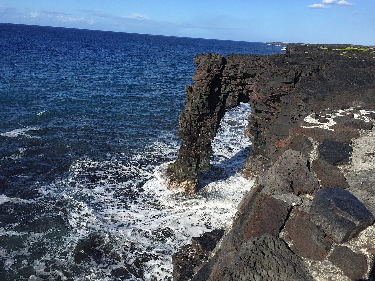

The arch won’t last forever. Given time, the waves will pull it down, leaving new cliffs to form behind it. That’s a spare, clear ending for a road full of change: a landform made by the same restless meeting of lava and sea that has shaped the coast.
8. What belongs in the car?
- Fill the tank before setting out; there’s no fuel along the road.
- Pack food and plenty of drinking water, especially for time at the coast or on foot.
- Bring rain protection for the upper forest and sun protection for the hot, bare coast.
- Give the drive a good part of the day, and more time if stopping at pit craters and Puʻu Loa.
- The road is unlit; nēnē sometimes stand on the warm pavement at dusk.
- On the way in, open sections of Crater Rim Drive fit naturally into the same outing.
- Conditions, closures and eruption activity in this part of the park are posted by the national park and the volcano observatory.
My favorite part is the slow change from wet forest to bare coast, with the road stitching them together.