
1. What kind of summit has no peak?
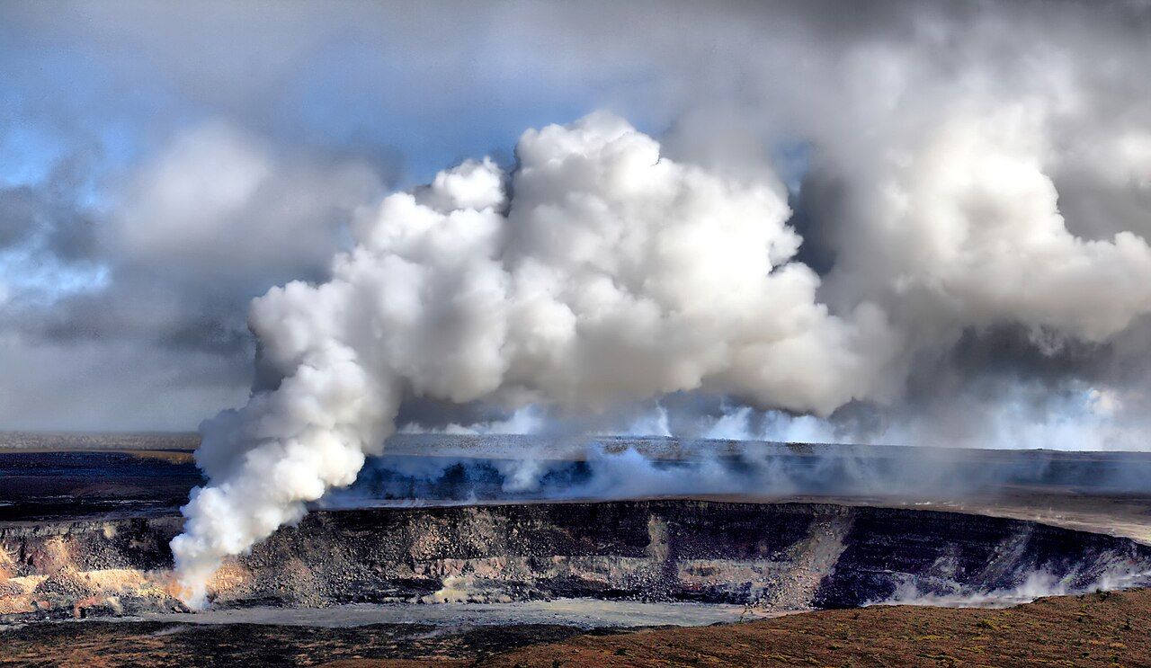
Kīlauea’s summit doesn’t announce itself with a high point to climb toward. Instead, the road gains height through rain forest, then passes out of the trees onto a wide, level-bottomed basin enclosed by cliffs.
That basin is the caldera, and Halemaʻumaʻu sits within it, often picked out by a plume of gas. The scale can take a moment to settle in: the summit isn’t a cone above the landscape, but a huge depression in it, with the crater set down in the middle.
For many people, this is the reason for coming to the island. And the view doesn’t hold still from month to month; what’s visible depends on what Kīlauea is doing, and the crater may be active or quiet.

2. How did the caldera get this shape?
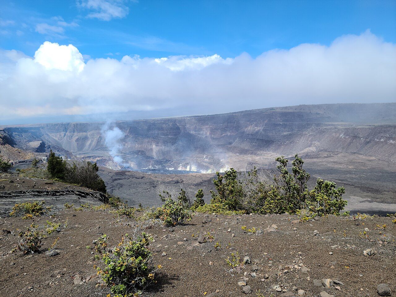
When magma drains from below, the surface above it can sink and leave a basin: that’s a caldera. Kīlauea’s has changed shape over centuries, but the shift that most clearly marks the present landscape came in 2018.
As lava poured out far to the east in lower Puna, the summit went through repeated collapses and its floor dropped. Halemaʻumaʻu became hundreds of meters deeper; long-standing overlooks cracked and slid away, and some sections of the rim road and trails have stayed closed.
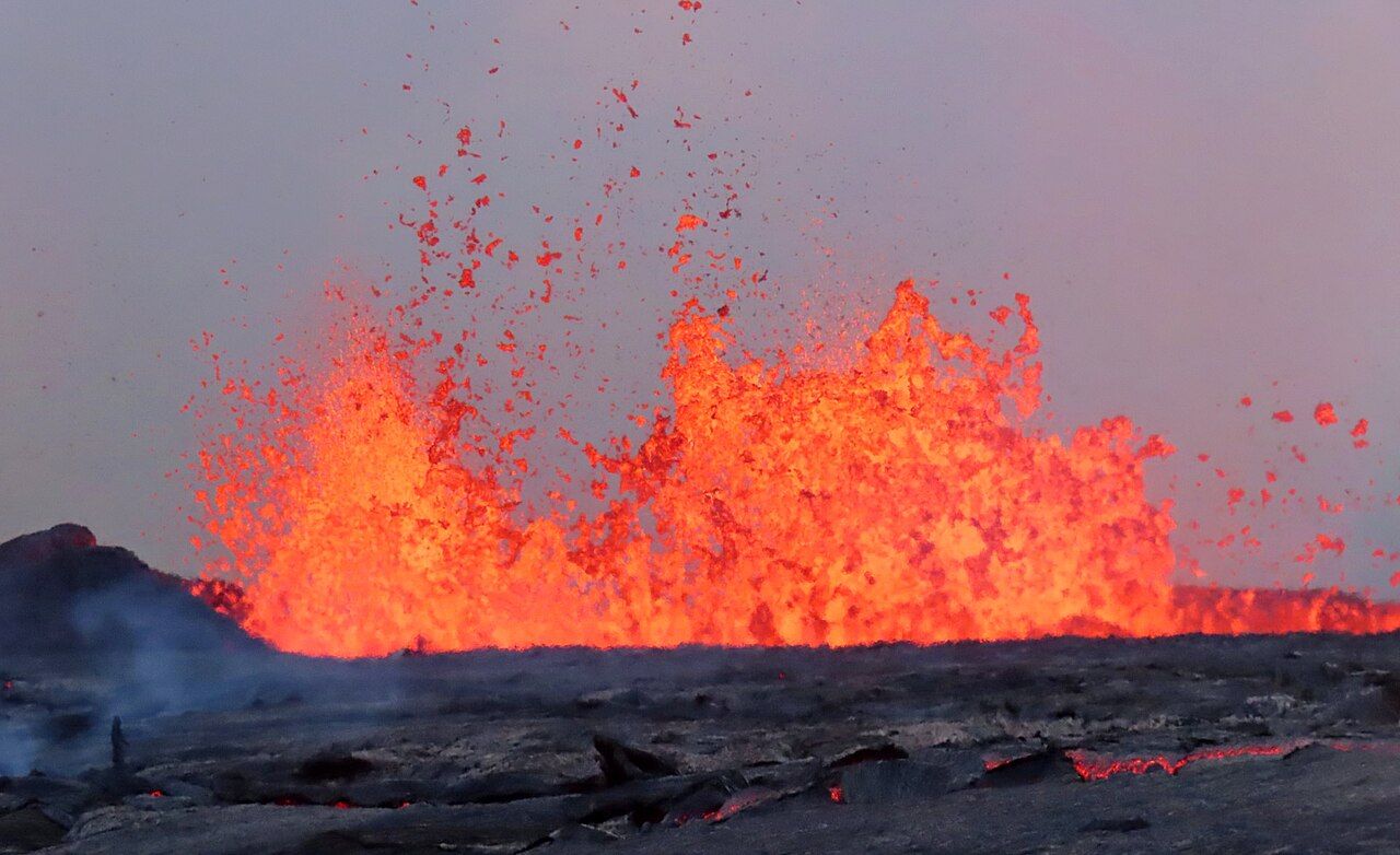
Since late 2020, eruptions have started inside the crater. Sometimes lava has pooled there as a lake; at other times, fountains have risen high enough to be seen from far across the park. Between eruptions, the crater can be quiet for weeks or months, with a steady white plume of steam and volcanic gas instead.
There’s a useful way to hold all those versions in mind: the caldera is not a finished landmark, but a place being remade. The walls, floor and open routes carry the record of that change, and a familiar view can look different again.

3. What does the rim mean to people?
Halemaʻumaʻu is often rendered as “house of the ʻamaʻu fern”; ʻamaʻu is a native fern common on young lava. For Native Hawaiians, the crater is the home of Pele, the volcano goddess, and remains a living place of prayer and offering.
That meaning sits alongside the geology, not in place of it. Hawaiʻi Volcanoes National Park has viewpoints and walking routes, but the rim is also a sacred place; a quieter voice and a little care with the ground feel right here.
Leave offerings untouched, and don’t take rocks or sand away. The simpler courtesy is to stay behind the barriers and let the place be what it is, rather than treating the edge like a stage for a photograph.
4. Where do the rim views begin?
The Kīlauea Visitor Center is near the park entrance, and a short walk from there reaches a view over the caldera. The open stretch of Crater Rim Drive and the Crater Rim Trail connect with other lookouts along the rim.
On the western side, Uēkahuna is the highest point on the rim, a bluff with a long view across the floor toward Halemaʻumaʻu. On the southeastern side, Keanakākoʻi faces the crater from another angle and is often suggested by rangers when lava is visible.
Which viewpoints are open depends on the eruption, gas levels and wind. The visitor center board posts the day’s conditions, and signs mark the routes; the cliffs are cracked and undercut, so a rim that looks solid can be hollow beneath.
The stepped walls show the shape left by the 2018 collapse, and old flows of different colors cross the floor; on clear days, Mauna Loa rises beyond the caldera.
If the crater is quiet, there’s still plenty to look at. The stepped walls show the shape left by the 2018 collapse, and old flows of different colors cross the floor; on clear days, Mauna Loa rises beyond the caldera.
5. What can older pictures tell us?
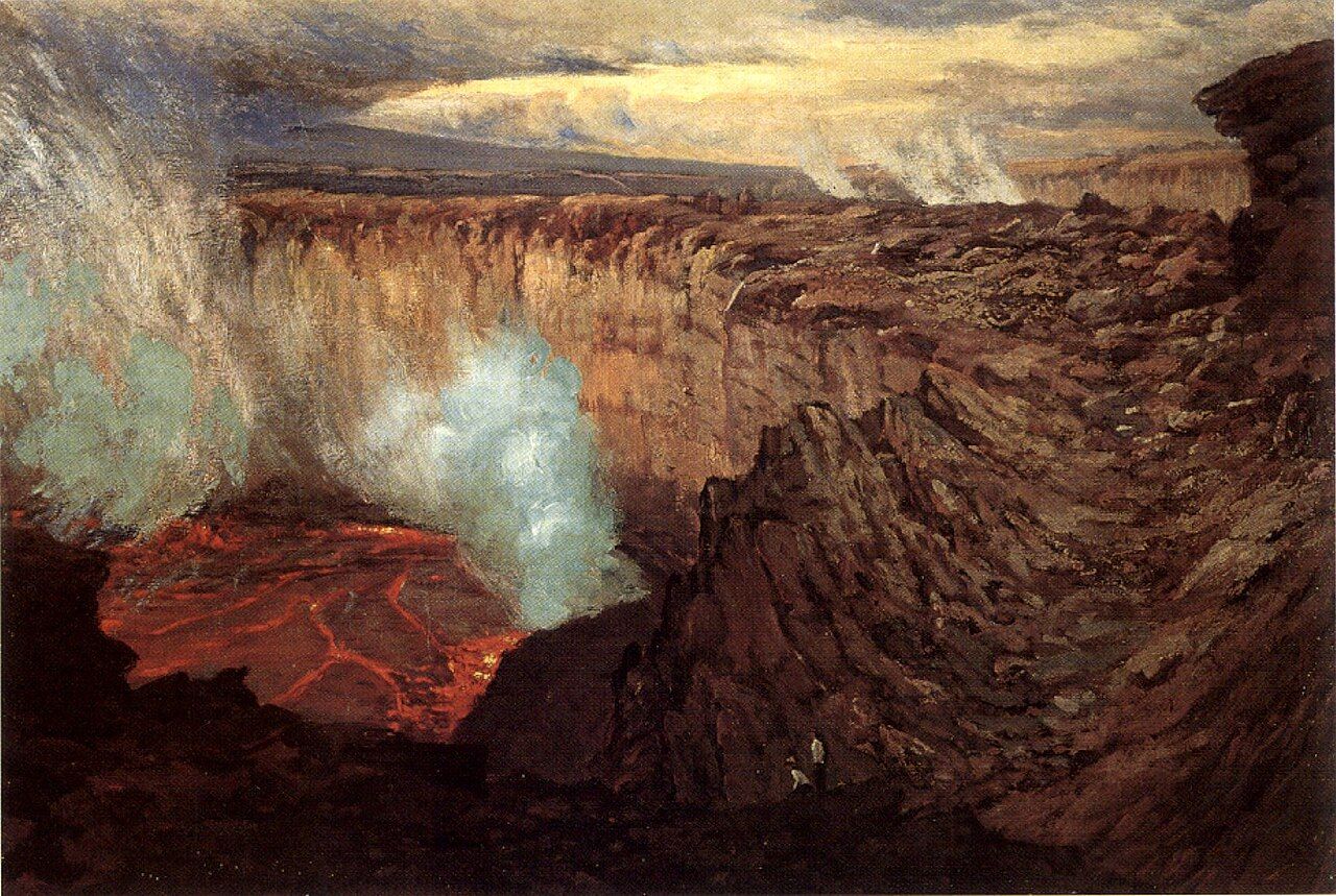
People have come to this rim for as long as there have been people on the island, while outside visitors have written about and painted it for two centuries. Early paintings show a very different-looking caldera, with a broad floor and active lava lakes glowing at night.
Set one of those images beside the present view and the point isn’t that one version is better. The summit has changed repeatedly, and the caldera in front of the viewer is one moment in a long sequence, not a permanent arrangement.
That’s why I keep coming back to the old images. Even a quiet stretch of gray floor belongs to the same story as the old glowing lakes, and another change will come in time.
Read next: Kīlauea, read across a day
6. What’s the walk down like?
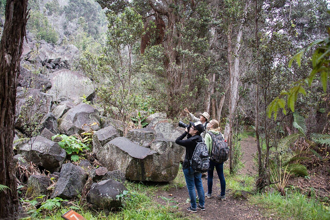
From the visitor center, the Halemaʻumaʻu Trail leaves the rim by way of a tight passage between mossy rock and ferns. The forest is damp and green, a striking contrast with the bare caldera floor below.
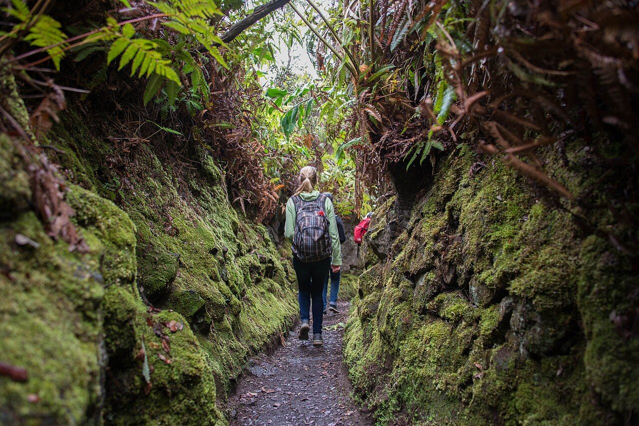

Earthquakes have damaged parts of the trail, including large slides in 1983 and the collapse of 2018, and only some sections have reopened. The route doesn’t offer one uninterrupted walk down to the floor, so the open sections matter more than the line on an old mental map.
Farther along, huge boulders from landslides set off by strong earthquakes make the cliffs’ scale hard to miss. If a walk across a crater floor sounds more appealing, the well-used route across Kīlauea Iki, just to the east, is the classic choice.

7. What changes when lava is visible?
During an eruption, the glow shows strongest after dark and before dawn, when lava light reflects off the plume. The roads and parking areas can fill quickly in the evening, and visitors may need to walk from wherever a parking spot turns up.
The summit is cool at night, and showers can pass through without warning. For an eruption visit, bring a red-setting torch, extra clothing for the chill, and a jacket for the rain; the weather can feel a long way from the coast.

Volcanic gas is the main summit hazard. Sulfur dioxide and the haze it forms, called vog, can affect anyone, with particular concern for children, pregnant visitors and people with heart or breathing conditions.
When wind carries the plume over a viewpoint, the park may close it at short notice. The guide to vog and safety has more about the gas and its effects.
8. How does a summit day fit together?
The rim views can be the whole outing, or one part of a day that includes a drive and a walk. The open part of Crater Rim Drive gives the caldera another angle, while Nāhuku lava tube adds a very different kind of landscape to the same visit.
At the summit, weather and visibility shape the experience as much as the crater does. Cool, wet conditions can sit above a hot coast; the page on rain and cold nights covers those layers.
- The Kīlauea Visitor Center is near the park entrance, with a short walk to a caldera view.
- Open viewpoints and trail sections depend on eruption activity, gas levels and wind.
- Stay on marked paths and behind barriers near the rim.
- For an active crater, the view may be lava and fountains, or a quiet hollow with a plume of steam and volcanic gas.
My favorite view is the quiet caldera, where the walls tell the story without needing to glow.