
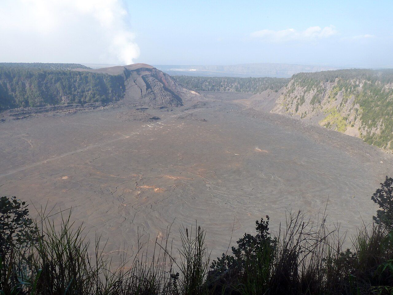
1. What does the crater look like from the rim?
From the overlook, Kīlauea Iki lies below like a long gray valley, forest gathered along its walls and a narrow trail crossing the floor. The name means “little Kīlauea,” which feels about right beside the much larger summit caldera.
The loop drops around 400 feet from rim to floor and covers about four miles. Most walkers take two to three hours, with extra time if the crater asks for a longer pause; it’s a proper hike, though not a technical one.
I like that the view gives away the route without explaining the place. The pale line across the dark basin looks almost too slight to matter, until the forest edges and the distances between people start to put its scale in perspective.
2. What happened here in 1959?
In late 1959, vents opened along the upper wall and sent lava fountains high above the crater. At times they reached roughly 1,900 feet, among the highest ever measured in Hawaiʻi, while falling cinders built the large cone of Puʻu Puaʻi.
Lava collected on the floor and made a lake many tens of meters deep. The eruption lasted only a few weeks, but the lake took decades to cool. Its surface crusted over quickly, while molten material remained inside for years; scientists drilled into it to study how a lava lake hardens.
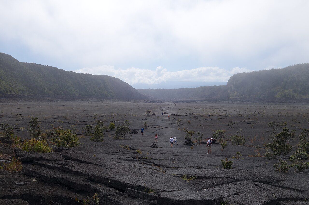

The floor is solid now, but cracks still give off steam after rain, with heat not far below. That contrast is the part I keep coming back to: a broad, quiet walking surface above a history that was anything but quiet.
The eruption lasted only a few weeks, but the lake took decades to cool.
3. Where does the trail enter the forest?
Most walkers begin at Kīlauea Iki overlook on Crater Rim Drive and take the loop anticlockwise, descending through the forest before crossing the crater. The route can also be joined from the Nāhuku parking area, so the first part of the walk depends on where the day begins.
Either way, the rim sections pass through dense rain forest, where ʻōhiʻa trees and hāpuʻu tree ferns keep the trail cool and green even when the day is hot. The footing shifts between roots, rock and steps, and after rain those surfaces can be slick.
Birds are part of this stretch, too. ʻApapane, a crimson honeycreeper, and yellow-green ʻamakihi feed in the ʻōhiʻa blossoms, their calls filling the canopy early in the day. There’s more about the plants and birds in the guide to ʻōhiʻa, ferns and forest birds.
The descent feels steady rather than steep, but it’s worth taking it slowly, especially on the way down. Walkers climbing uphill need room, and the damp roots aren’t improved by hurrying.
4. What changes when the trees fall away?
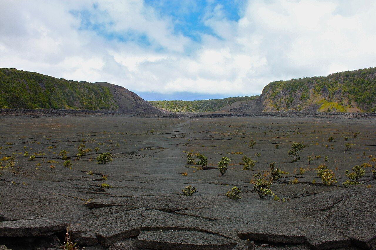
At the bottom, the forest gives way to a broad plain of gray and black lava. The crust is cracked and folded into low ridges, places where the surface buckled as the lake cooled; forest walls rise around the floor, and Puʻu Puaʻi stands at the far end.

Read next: Kīlauea’s summit, from the rim inward
After the close, green trail, the open floor feels startlingly wide. There’s no shade here, and the dark rock takes in the sun, while clouds and showers can change the feel of the walk quickly. The exposed basin is the hike’s great visual shift, and also the part that asks for a little more care.
The trail across is marked by ahu, small piles of stacked stones. They mark the route, so follow them and stay on the worn line rather than wandering across the crust. Some cracks are deeper than they look, and the crust between them can be thin above hollows.
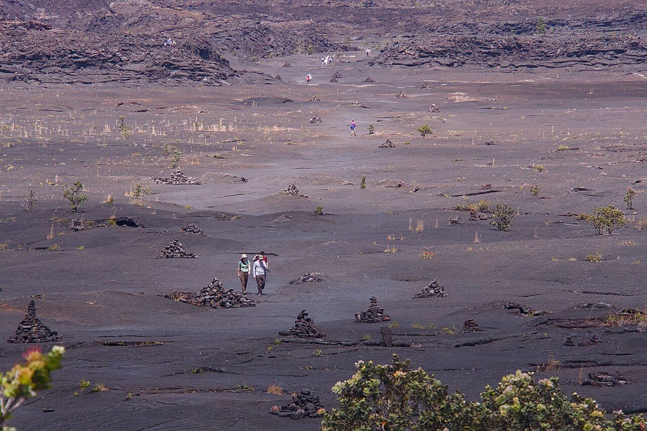

Leave the ahu as they are; don’t add stones or build new ones. The route is easier to read when those markers stay as they were, and the crater is better for being left alone.
5. What is growing on the lava?
Life is returning in small patches, not all at once. Young ʻōhiʻa shrubs and ferns grow in cracks where moisture gathers, while pink flowers of an introduced knotweed have taken hold in places.
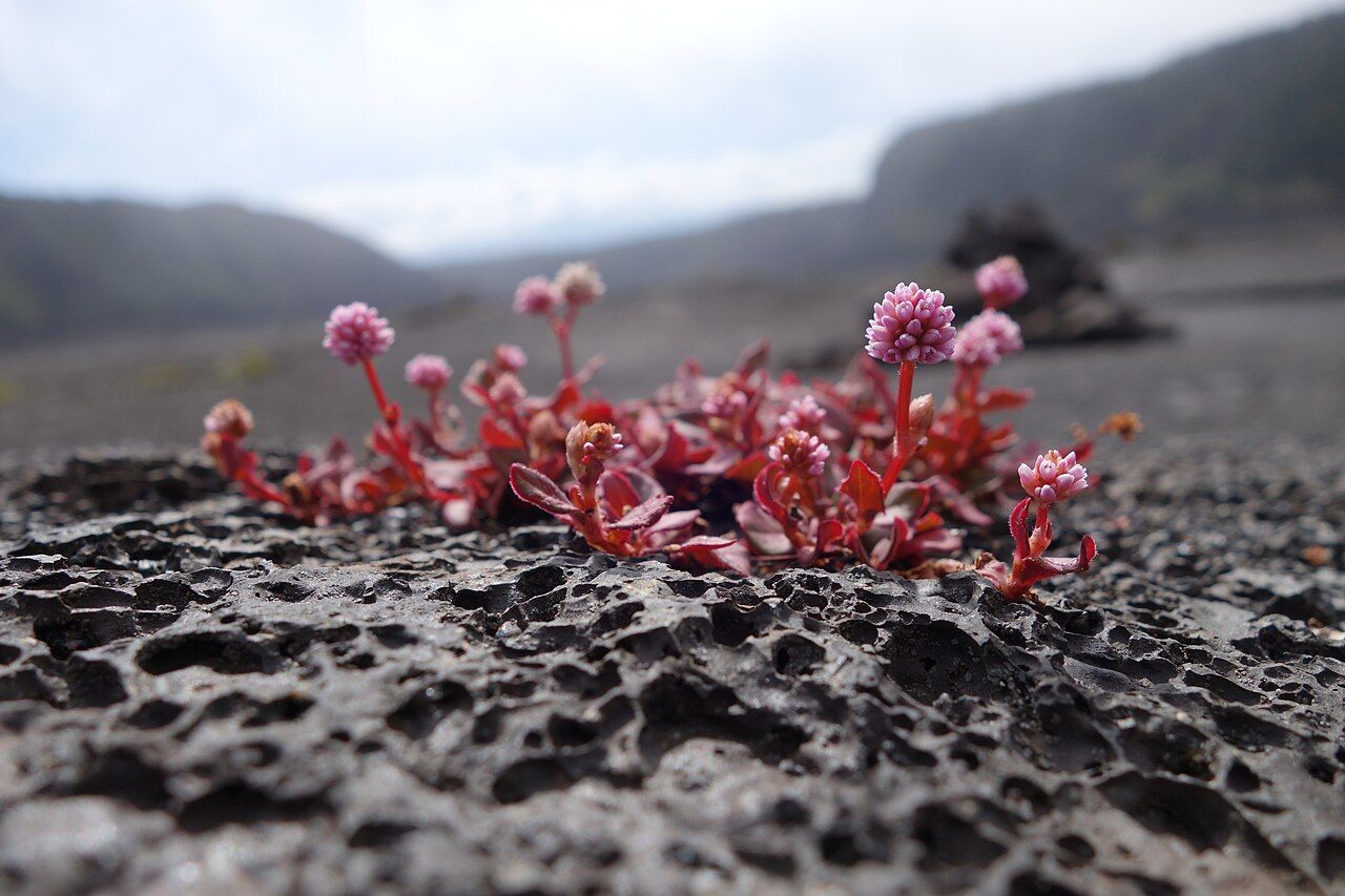

It’s easy to want to get close to the little green and pink signs of life, especially against all that gray and black. Looking and taking photographs are the better way to do it; walk around the plants rather than over them.
Near the vent end, the floor rises toward the wall where the 1959 fountains played. The rocks turn reddish and broken, and the slope above shows layers of cinder from the building of Puʻu Puaʻi. It makes a natural place to stop, drink water and consider what a lava lake here must have meant.
6. What if the full loop feels like too much?
The overlook beside the parking area gives the classic view down the crater, and a short walk along the rim path brings slightly different angles as the forest opens and closes. There’s no need to make the full descent for the landscape to register.
Another shorter option is the paved Devastation Trail near Puʻu Puaʻi overlook. It crosses forest buried by cinders in 1959, where bleached snags rise above gray ground cover and new growth pushes through. The trail is level and short, and shows the other side of the eruption: cinders falling downwind from the fountains rather than lava filling the lake.
Families with young children often go partway down the switchbacks, then turn back before reaching the floor. That still gives a feel for the forest and the descent without committing to the whole loop.
7. What does the return look like?
The climb back to the rim makes the crossing visible in a new way. From above, the trail is a thin pale line across the crater floor, and the people walking it are only specks.
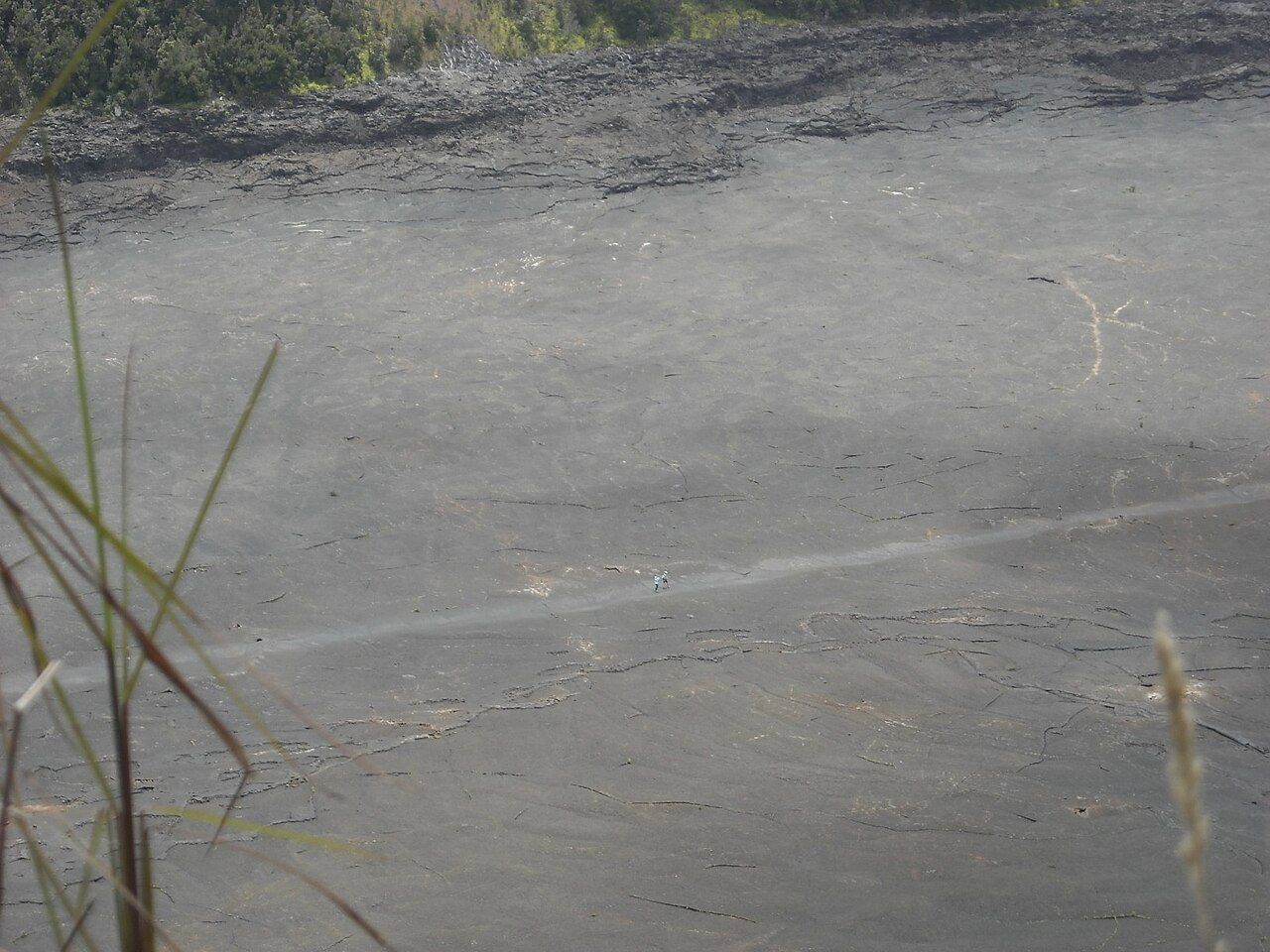

It’s a good moment to take in the proportions: the floor where the lake cooled, the high fountains, and the forest that took the cinders. The path you’ve just walked connects those parts more clearly than the overlook alone can.
Back at the rim, a short drive leads to Nāhuku lava tube, a cool, shaded follow-up. With more time, Chain of Craters Road continues toward the coast. The crater has plenty to hold the attention on its own, but those nearby stops make a natural continuation.
8. What belongs in the day pack?
The trail sits around 3,500 to 3,900 feet, and the exposed floor and forest rim can feel like different walks. Mornings are usually best: the floor is cooler, and parking is easier to find before the overlook and Nāhuku areas fill by mid-morning.
Rain can soak the trail quickly, while the crater floor has no shade and can feel much hotter than the rim on a clear afternoon. The summit is cool, especially in winter or early morning, so a little preparation for both sun and rain makes the walk more comfortable. The guide to rain, cold nights and what to pack has more on the summit climate.
- Sturdy, closed shoes with good grip for roots, steps and sharp lava.
- At least a liter of water per person, more on hot days, plus a snack.
- A sun hat and sunscreen for the floor, and a light rain jacket for the rim.
- A warm layer for winter or early morning.
Kīlauea Iki is at its best when the walk leaves room for both the forest and the strange, open quiet of the crater floor.