What remains of the old summit loop?
Crater Rim Drive was made to circle Kīlauea’s summit caldera, connecting overlooks, trailheads and the old observatory in one long loop. For decades, it was the road most visitors took to see the volcano; now it’s better understood as two open stretches, with closed ground in between.
That change doesn’t make the drive feel empty. The open road still moves through very different pieces of the summit: steaming cracks in the forest, sulphur-stained ground, a crater overlook and a wet stretch of rain forest. Most stops are close to the car, and the whole thing can fit a rainy morning or a first afternoon in the park.
Why does the road end where it does?
The rim road has never been separate from the forces that keep reshaping this place. Earthquakes crack the pavement and bring rockfalls; gas from Halemaʻumaʻu can drift across the road when the wind turns, and the summit collapse in 2018 swallowed parts of the rim.
Some closed pieces have been left to the forest rather than repaired. An old survey photograph shows the narrow road bending through tree ferns and ʻōhiʻa, the native tree that fills much of the forest here. Those curves are now part of the record, not a route to follow by car.
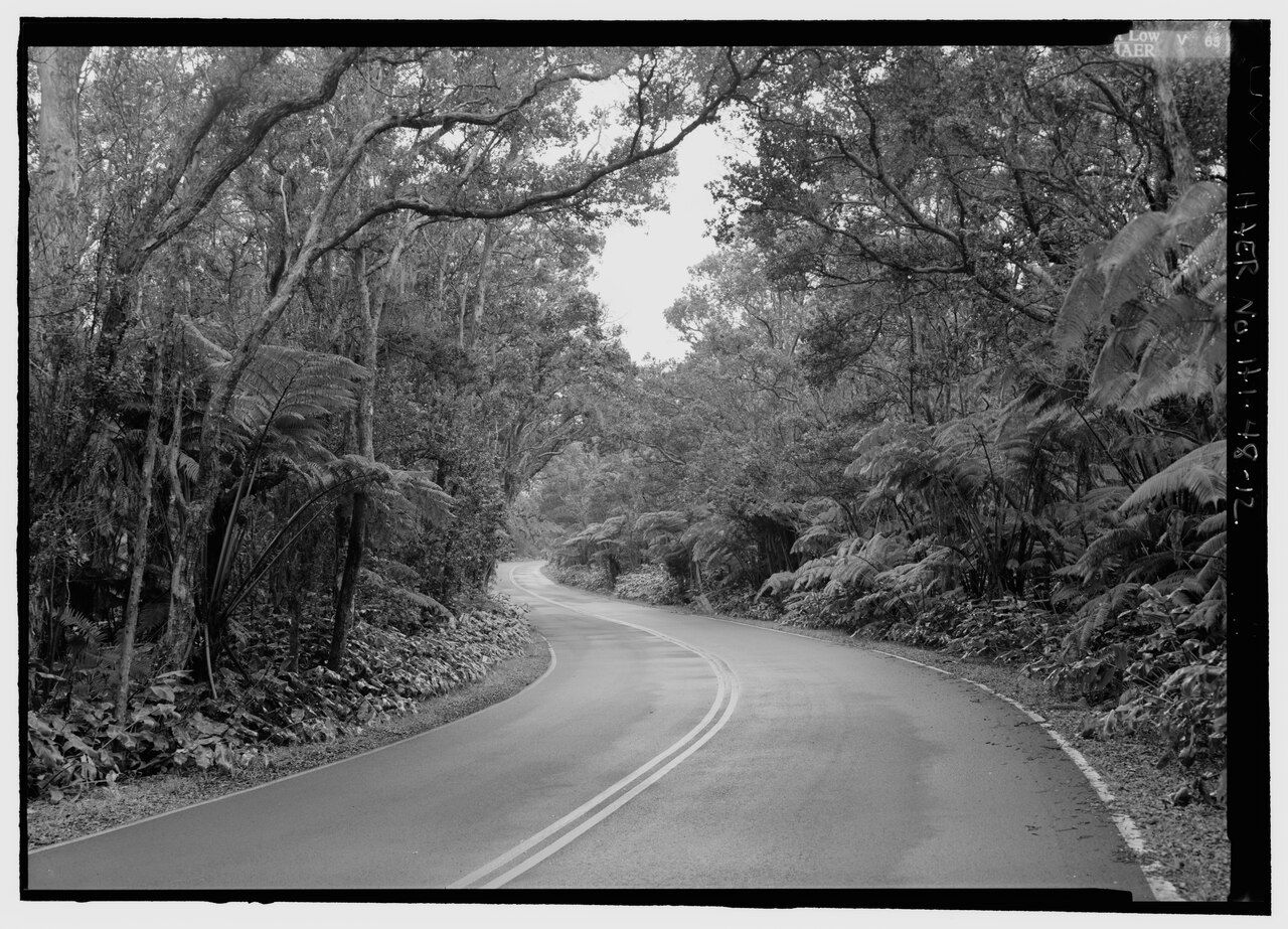
Black-and-white survey photo of an old section of Crater Rim Drive closed after a 1984 earthquake.Lowe, Jet, creator — Public Domain The open stretches don’t form a tidy circuit anymore, and which parts are open can change at short notice. I like that the old pictures make the absence visible: the road’s story is written as much in what has disappeared as in the pavement still carrying cars.
What’s happening at the steam vents?
A short way from the visitor center, steam comes through cracks among grass and shrubs. On cool mornings, the plumes are easier to see, rising from ground that looks ordinary until it starts breathing into the air.
Rain sinks into the ground, meets rock heated by magma far below, and comes back up as steam. A short path leads from the parking area toward the caldera, with vents on either side; the warm, damp air makes this a small stop with a distinctly volcanic feel.
The path is the place to watch from. Heat softens the ground around the vents, which can give way, and the steam itself is hot enough to scald. Children belong close and by the hand here; the fragile edge isn’t a place to wander across for a better look.
What makes the Sulphur Banks so different?
Nearby, a boardwalk crosses Haʻakulamanu, also known as the Sulphur Banks. Volcanic gases seep out of the earth and leave yellow sulphur crystals on the rocks, with red and white patches where the gases have changed the soil.
There’s a rotten-egg smell, from hydrogen sulphide, among the gases released here. The boardwalk keeps visitors above hot, delicate ground and away from the strongest fumes. Those gases can be a real concern for people with asthma, heart or lung problems, and for anyone who’s pregnant; the stop may not suit everyone.
Read next: Kīlauea’s summit, from the rim inward
The route carries on through forest, where hāpuʻu tree ferns crowd beneath the ʻōhiʻa. It loops back by a different line from the one used to arrive, making a pleasant change after the exposed, sulphur-marked stretch. The walk takes well under an hour at an unhurried pace.
What can be seen from Kīlauea Iki?
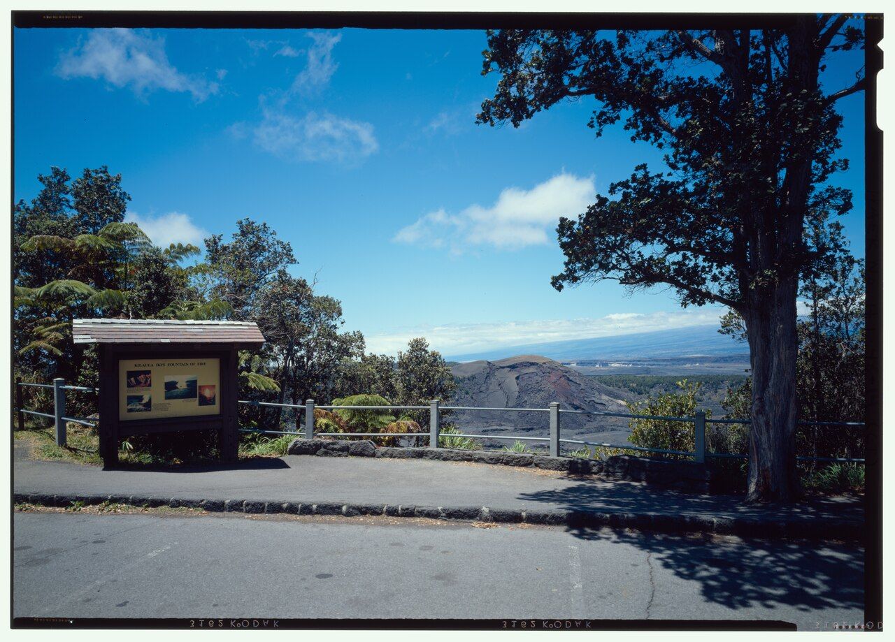
On the eastern stretch, a pullout looks down into Kīlauea Iki, whose floor held a lake of lava in 1959. Puʻu Puaʻi, a tall cinder cone built by fountains during that eruption, rises along the far rim.
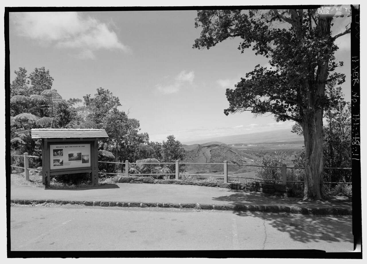
Black-and-white survey photo of the Kīlauea Iki overlook on Crater Rim Drive.Lowe, Jet Related names: Bureau of Public Roads Bitulithic Concrete an — Public Domain From the railing, walkers crossing the gray crater floor can look tiny against the broad surface below. It’s a view I’d happily linger over: there’s a clear sense of scale, and the old lava lake is close enough to read as a place rather than a distant shape.
The overlook also marks the start of the trail descending into the crater. The guide to walking across Kīlauea Iki has the details on distance, footwear and what to carry for that longer walk.
Where does the road turn green?
Farther east, Crater Rim Drive enters dense, wet rain forest, the greenest part of the summit area. The parking area for Nāhuku, the Thurston lava tube is here, and it’s among the park’s most visited stops; the lot fills quickly from mid-morning.
Beyond Nāhuku, the road meets Chain of Craters Road, which heads south and down to the sea. That drive takes half a day in itself, and there’s no fuel, food or water along it, so this junction is a sensible place to have the car stocked before turning off the rim.
The forest has its own small soundtrack. Red and yellow-green honeycreepers feed in ʻōhiʻa blossoms, and on still mornings their calls carry a long way through the canopy. I’d take this stretch slowly; after the open caldera, the close green and bird sounds make a lovely change.
How does the drive feel as a whole?
These stops make a good sampler of the summit without requiring a long walk at every turn. The steam vents are brief and strange, the Sulphur Banks offer a more involved boardwalk wander, and Kīlauea Iki gives the strongest view down into a crater.
Rain can sweep across the summit even when the sky starts clear, and the paths can be wet, uneven and rocky. Closed shoes and a rain jacket fit the conditions better than anything delicate. Keep to the marked paths and boardwalks, since hot soft ground, cracks and drops sit close to the road.
Driving slowly matters, too: nēnē, the native Hawaiian goose, sometimes walk along the verges, and feeding them isn’t allowed. Taken together, the open sections can fill a morning without making the day feel crowded. Low cloud can blend with steam and mist until the summit seems to breathe.
What’s worth keeping in mind?
Crater Rim Drive works best as a chain of small stops, not a loop to finish quickly. The old road once tied the summit together; the present route leaves enough variety to make its broken shape feel like part of the story.
For another note on the gases around the summit, continue with vog and staying safe.
- Bring a rain jacket; showers can cross the summit quickly.
- Wear closed shoes for wet, uneven and rocky paths.
- Stay on marked paths and boardwalks around hot, soft ground.
- Drive slowly near the verges, where nēnē sometimes walk.
The national park · Kīlauea
Crater Rim Drive, in pieces and still worth taking slowly
The old summit loop is now two open stretches, with steam vents, sulphur-stained ground, a crater overlook and rain forest along the way.
- Elevation
- Around 3,700 to 4,000 feet
- Drive
- A few minutes from Volcano village
- Getting there
- From the park entrance on Highway 11
- Bring
- Rain jacket, closed shoes, water, warm layer
Aloha noteSteam rising from the ground has long been part of daily life up here. Watch it from the paths and leave the vents and their crystals undisturbed.